India’s oldest mountain range has suddenly become the country’s newest political battlefield. The Aravallis—older than the Himalayas, quieter than election rallies, yet more consequential than many policy debates—now sit at the centre of an unusually fierce confrontation over how ecology is defined, governed and, ultimately, exploited. What appears outwardly as a technical dispute over geological criteria has morphed into a full-blown ideological clash, with one side accusing the state of environmental liquidation and the other claiming scientific precision. The intensity of protests and counterclaims reveals something deeper: a growing anxiety over whether environmental governance in India is being driven by ecological wisdom or administrative convenience.
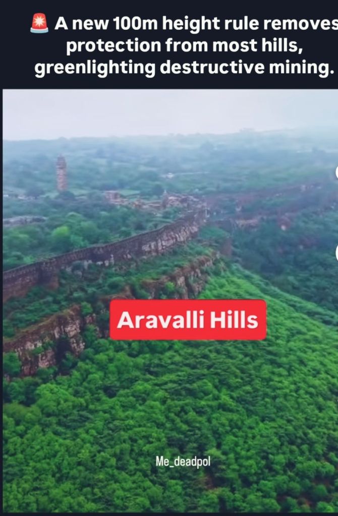
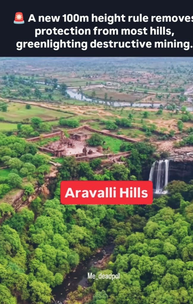
At the heart of the controversy lies a deceptively simple question: what exactly qualifies as part of the Aravalli range? The newly approved framework relies on an elevation-based threshold tied to “local relief,” a term that sounds neutral but carries immense political and ecological consequences. In practice, this method risks excluding vast stretches of low-lying hillocks, valleys and ridges that have historically functioned as an integrated ecological system. Critics argue that the range is being reduced from a living landscape into a fragmented cartographic abstraction. Supporters insist the definition is more scientific and uniform. The paradox is striking: the same formula is being read by rival political camps as guaranteeing protection for most of the range by one, and stripping protection from most of it by the other.

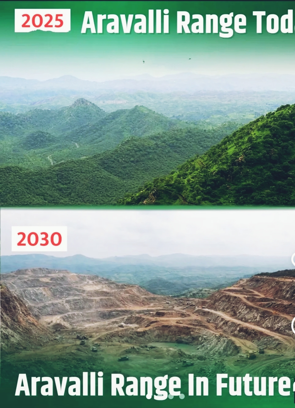
This is not merely an argument about percentages; it is about scale and consequence. When governments speak in decimals, ecosystems respond in hectares. Even a fraction of land opened up in an ecologically sensitive zone can translate into tens of thousands of acres exposed to mining, construction and speculative development. The Aravalli’s are not decorative hills; they are a critical ecological buffer. They recharge groundwater in one of India’s most water-stressed regions, slow the eastward creep of desertification, shelter biodiversity and act as a natural dust barrier protecting densely populated urban corridors. Fragmentation at this scale is not reversible damage—it is structural harm.
What fuels political suspicion is history. The Supreme Court had earlier expressed discomfort with similar elevation-based benchmarks, precisely because they were seen as inadequate to protect the range. Past mapping exercises had identified large contiguous stretches as bearing Aravalli characteristics, and those findings were intended to curb illegal mining, not facilitate its re-entry through definitional loopholes. Former administrations point to aggressive enforcement regimes—satellite monitoring, dedicated funds, and thousands of police cases against illegal operators—as evidence that strong protection was both possible and effective. Against this backdrop, any redefinition that coincides with reduced enforcement intensity is bound to appear suspect, regardless of official assurances.
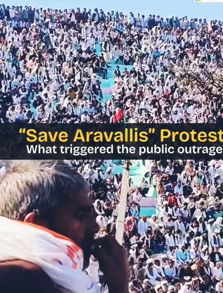
The confrontation has therefore spilled out of courtrooms and committees into the streets. Mass mobilisations and protests signal that this is no longer a niche environmental issue but a politically resonant symbol. For the opposition, the Aravallis have become shorthand for a larger critique: that economic growth is being privileged over ecological survival, and that regulatory language is being weaponised to benefit entrenched interests. For the government, the counter-narrative is equally emphatic: that environmental protection must be grounded in clear, standardised criteria rather than emotional appeals or ambiguous geography. The result is an unusually polarised debate in which compromise seems elusive.

What makes this moment especially significant is that it exposes a deeper fault line in India’s development model. Is sustainability a living principle rooted in landscape-level thinking, or a compliance exercise managed through definitions and percentages? Hill ranges like the Aravallis do not function as isolated peaks; they operate as interconnected systems of slopes, forests, wetlands and human settlements. Their value lies precisely in what rigid metrics struggle to capture—continuity, resilience and cumulative impact. Reducing such systems to narrow thresholds risks hollowing out protection while preserving its appearance.
In the end, the Aravalli dispute is less about geology than governance. It is about who gets to define nature, whose knowledge counts as “scientific,” and how the costs of development are distributed across generations. A mountain range that has survived millions of years of climatic upheaval now finds its fate hanging on administrative language and political will. If sustainability is treated as a box to be ticked rather than a system to be safeguarded, the consequences will not remain confined to Rajasthan’s hills. They will be felt in falling water tables, rising dust storms, vanishing biodiversity and an increasingly uneasy relationship between the Indian state and its ecological inheritance.
Visit arjasrikanth.in for more insights

One response to “A Mountain Is Shrunk on Paper: The Aravalli War Between Maps, Mines and Moral Authority”
We must save Aravali hills
LikeLike